
Beaufort County Neighbors by Block
The County's documented tools support a parcel-by-parcel neighborhood review. GIS can show a selected address, surrounding parcels, streets, roads, municipal boundaries, voting precincts, and aerials. The linked real-property record gives fields for the selected parcel, including owner and mailing information. The Register of Deeds and plats add recorded party and legal-description context. BDC and the Historical Society offer historical context. Each source has a limit, so a neighbor search should retain the question it actually answers.
| Source | What It Shows About a Block | Access |
|---|---|---|
| County GIS parcel and buffer tools | Parcels geographically near an address, plus street and address features | Public map with documented layers |
| Parcel and real-property card | Owner of record, situs, mailing address, acreage, and class for one parcel | GIS-to-real-property link; confirm live record |
| ROD and plat chain | Recorded ownership change and subdivision geometry | Neumo, legacy New Vision, old plats, or counter |
| Voting-precinct layer | Civic district boundary context | County GIS, not a block voter roster |
| BDC and Historical Society | Local maps, newspapers, and neighborhood history | Library or historical contact, not member directories |
| Municipal and county boards | Published public contacts when a jurisdiction provides them | Jurisdiction-specific; no countywide HOA roster verified |
An owner of record can differ from the people who occupy a place. A parcel may be a trust, common area, condominium association, business, vacant lot, or multi-unit property. That is why a Beaufort County neighbors search should not promise a household list.
Mapping Beaufort County Neighbors by Parcel
The Beaufort County GIS map documents an actual adjacent-parcel method. Search an address, street, PIN, or owner name. For a broader documented address match, enter the number, street, and a percent sign. Use the map's result list, Zoom to, Pan to, Flash, selection tools, drawn shape, buffer, or spatial relationships to identify candidate parcels. Open each parcel rather than assuming the next house number is adjacent.
Source: the City of Beaufort GIS page illustrates the municipal mapping layer available for city-context questions.
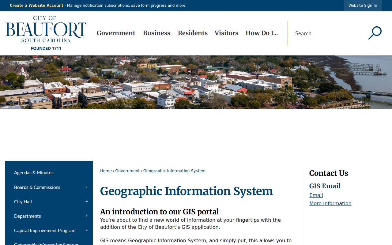
For a city address, municipal GIS context can help with zoning or historic-district geography, while the County parcel map remains the countywide parcel doorway.
- Locate the starting address or PIN in County GIS and note its mapped situs and layer date.
- Use a small buffer, shape, or spatial relationship to identify nearby candidate parcels.
- Open the real-property link for each selected parcel and retain its separate PIN, listed owner, situs, and mailing address.
- Compare lots, blocks, road edges, common areas, or water features in the plat before calling two parcels adjacent.
- Use the recorded deed search for a particular parcel's party and legal-description trail.
The process is address to map to candidate parcel to individual parcel record to recorded-document context. It is more reliable than a screen-only interpretation of who sits next to whom.
Beaufort County Neighbors and Owner Records
County GIS Enhanced Search accepts PIN or owner name for parcel searching, street name for streets, and a full or partial address for address searching. A documented result can show a parcel heading or PIN, situs address, class, owner and additional owner field, mailing address with city, state, and ZIP, acreage, and a link to real-property information. Map actions include Zoom to, Pan to, Flash, Show pop-up, View in Attribute Table, Clear Buffer, and Clear Results.
Those fields describe the selected parcel record. The mailing field can be a correspondence location, so it should never be treated as a residency finding. The situs is where the land is located. A recorded deed can show a grantee address at the transaction date, but it also is not proof of current occupancy. Preserve the difference in every neighbor note.
- Parcel or PIN
- The county identifier that links a mapped property to its real-property and recorded-document trail.
- Situs address
- The physical location of the parcel.
- Mailing address
- Correspondence information for an owner or tax account, which can be elsewhere.
- Plat
- A recorded map that can show subdivision, lot, block, road, and tract geometry.
Note: GIS measure and draw functions support map review but do not replace a survey or recorded legal boundary.
Beaufort County Neighbors Through Deeds
After selecting a parcel, use the Beaufort County Register of Deeds Official Records Search for party, subdivision, document-type, document-number, and recorded-date searches. Search the current listed owner as grantee or use the legal description. The latest deed can identify an earlier grantor; the legal description, lot, block, map, and PIN help test whether the chain remains with the same land. ROD staff do not conduct official searches, so identify the document before requesting a copy.
For complete cross-era work, use Neumo for converted and current records from February 23, 2026 and legacy New Vision through February 19, 2026. The legacy Document Type INDEX path reaches older handwritten grantor/grantee and mortgagor/mortgagee index books. Plats can define actual subdivision relationships, but a plat shows land geometry, not a present occupant.
When an association or subdivision name appears, confirm it against a plat, recorded document, and municipal layer before making contact. The research did not locate an authoritative countywide HOA or neighborhood-association directory, so no member list or claimed roster should be created from property data.
Beaufort County Neighbors and Civic Maps
County GIS holds municipal-boundary, voting-precinct, county-council, fire-zone, road, and aerial layers. These explain records geography. A precinct identifies civic representation, not the people registered along a block. The official voter service, MySCVotes, needs a name, county, and date of birth as shown on a registration card. It is not a public street or block browse tool.
The County Board of Voter Registration and Elections manages local questions and records requests. The research did not locate a current official form or fee schedule for a broad voter-file request, and South Carolina's Address Confidentiality Program protects qualifying participant materials. A missing voter result can be a legal or design limit, not a reason to infer information from a map.
Map context. A voting precinct, municipal boundary, or aerial view describes geography. It does not identify residents or establish that a person lives at a parcel.
Beaufort County Neighbors History Contacts
For a neighborhood-history question, the right contact may be historical rather than a private roster. BDC holds local genealogy, maps, microfilm, newspapers, photographs, and community context. The Beaufort County Historical Society, established in 1939, accepts historical questions at beaufortcountyhistorical@gmail.com and PO Box 55, Beaufort SC 29901. These channels can help with old subdivision names, maps, and local history. They are not verified sources of current households or association membership.
| Beaufort District Collection | 311 Scott Street, Beaufort; 843-255-6468; request maps, newspapers, microfilm, and source-specific historical context. |
|---|---|
| Beaufort County Historical Society | Historical questions at beaufortcountyhistorical@gmail.com; PO Box 55, Beaufort SC 29901. |
| City or County office | Use the parcel's municipal-boundary layer to choose the public department or board contact. |
Start with a confirmed subdivision or historic place name. That avoids treating a modern mailing label, entity address, or loosely defined community name as an association identity.
Beaufort County Neighbors Source Comparison
Official parcel research and commercial neighbor tools serve different purposes. County sources show the provenance of a particular parcel record and allow the reader to compare its date, legal description, and custodian. Commercial tools can combine public and claimed data, yet may be stale, incomplete, or misassociated. Neither type supplies an entitlement to utility, delivery, or customer information.
| Approach | Strength | Limit |
|---|---|---|
| County GIS and parcel card | Direct map and parcel context tied to a documented county system | Shows selected parcel facts, not every household member |
| ROD and plats | Recorded party trail and legal land geometry | Transaction parties and boundaries are not current occupancy proof |
| Commercial neighbor category | May present a broad lead to verify | Can be stale, incomplete, or wrongly associated; not a custodian record |
For a full named-street records trail, use the Beaufort County street directory. The block method remains deliberately narrow: select nearby parcels, read each parcel separately, and confirm land relationships with records.
Beaufort County Neighbors Record Notes
Keep a small, parcel-specific note for each nearby property: the starting address, selected map layer, date viewed, PIN or DMP, situs, owner-of-record field, and any deed or plat reference. This preserves the difference between a visual map relationship and a recorded land relationship. The County GIS guide permits zooming, panning, flashing a result, opening a pop-up, viewing an attribute table, clearing a buffer, and clearing results. Those tools are helpful for repeatable map review when labels overlap or an address has multiple units.
A single street segment can include a condominium parcel, association common area, vacant lot, road, marsh edge, or waterway. A small drawn shape or buffer identifies candidates, not legal adjacency. Compare the lot or tract description and plat reference for each candidate before deciding whether it shares a line, roadway, common space, or water feature with the starting parcel. For a boundary dispute or title conclusion, recorded plats and deeds remain the relevant records, with appropriate professional or legal help where needed.
Privacy Limits for Beaufort County Neighbors
Records leave important things private. Parcel tools normally do not surface every household member, utility customers, delivery data, DMV address data, or protected-person information. South Carolina's Address Confidentiality Program lets qualifying participants use a substitute address with state and local agencies and courts. From January 1, 2026, qualifying active or former judges and certified law-enforcement officers also have a route to request removal of certain home details from government webpages.
Lawful use. Use Beaufort County neighbor records for personal, historical, civic, property, estate, or safety research. Never use any record to stalk, harass, threaten, intimidate, or harm another person.
South Carolina FOIA does not override protected addresses, confidential vital records, sealed court material, or motor-vehicle privacy law. If a record seems incomplete or incorrect, ask the specific custodian about its access or correction process instead of trying to assemble a private household profile.